Planning
The Airfield is approximately 46 acres (18.5ha) and was acquired by Lec Refrigeration and the grass runway opened after the war in the 1940's. The airfield was vastly improved in 1984 with the creation of a hard tarmac surface with runway lights by Charles Purley and his son, David. There was a hanger built at the same time but this was subsequently damaged by a fire in 2001 and taken down.
Local Plan and Enterprise Bognor Regis
The draft Arun Local Plan (2014) identifies the Lec Airfield (Airfield Park) as one of four strategic employment development sites located on the northern edge of Bognor Regis called Enterprise Bognor Regis (see EBR leaflet below). EBR comprises 70 hectares of land at Oldlands Farm, Salt Box, Rowan Way Caravan Park and Airfield Park which can accommodate 150 businesses and provide 4,000 jobs.
The emerging Arun Local Plan is focussed on regeneration, employment creation and economic growth. The Local Plan Inspectors, in their conclusions on OAN (February 2016) recognised the important role that EBR will play in meeting employment growth.
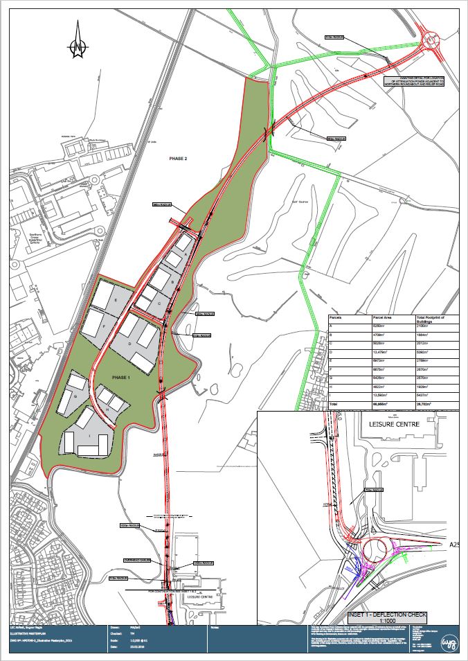
SDLL has updated its technical work to produce site-specific reports covering highways/access, environmental and flood risk. These reports identify and assess the site constraints, and propose a range of options and potential solutions. This information has been shared with ADC to inform the Local Plan process. An updated illustrative masterplan has been prepared (see below).
The key elements of the Illustrative Masterplan are:
- Re-aligned North-South Relief Road with the added benefits this can offer
- North-South Link Road raised on an embankment as necessary to allow for flood risk
- Development in a parkland setting with significant greenspace/biodiversity areas and landscape buffers
- Access provided to the land that makes up the remainder of allocation to the north (Phase 2)
- Opportunities for cycling and walking routes linking to the town centre and surrounding areas
- Development parcels totalling approximately 6.7 ha.
- Building footprints totalling approximately 27,000 sqm (rounded to the nearest 1,000 sqm and assuming 40% of development parcels are occupied by buildings with the remainder forming parking, access and landscaping) and a total floorspace of approximately 36,000 sqm.